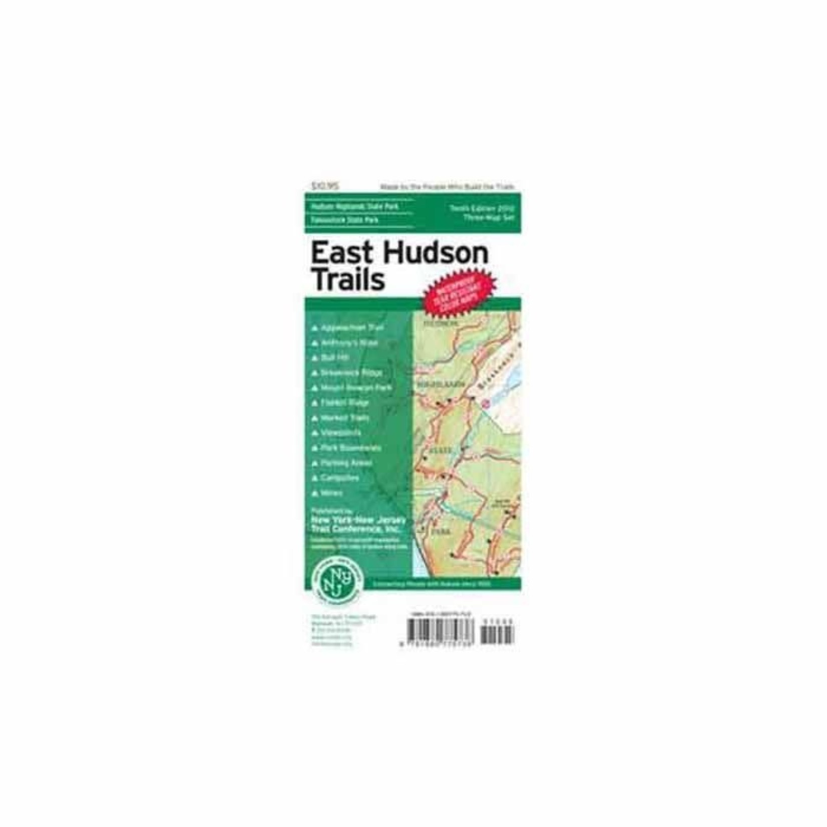
The East Hudson Trails Map by the New York-New Jersey Trail Conference is a three-map set featuring more than 150 miles of trails in the New York Highlands east of the Hudson River. The maps are printed in vibrant color on waterproof and tear-resistant Tyvek, and are a must-have for enjoying the rich outdoor experiences throughout the Hudson Highlands region.
This 2018 edition includes new trail mileage numbers, new detailed contour lines, and multiple trail updates and improvements. Among the significant trail changes include a revised trail system at Manitou Point Preserve, a newly-built section of Highlands Trail, revised blaze colors in Manitoga, addition of trails in Garrison School Forest, and large parkland additions to Hudson Highlands State Park Preserve and Fahnestock State Park.
Map features include:
- More than 150 miles of marked trails in portions of Dutchess, Putnam, and Westchester counties
- Parklands including Clarence Fahnestock Memorial State Park, Hudson Highlands State Park Preserve, Castle Rock Unique Area, Hudson Highlands Gateway Park, Manitoga, Manitou Point Preserve, Mount Beacon Park, Nelsonville Nature Preserve, Watergrass Sanctuary, and West Point Foundry Preserve
- More than 20 miles of the Appalachian Trail as it passes through Putnam County
- The popular Breakneck Ridge destination
- 20-foot elevation contours
- 1:31,683 scale (2 inches = 1 mile)
- Convenient map sizes to carry and use on the trail
- Parkland boundaries
- Unmaintained trails and woods roads
- Viewpoints, campsites, mines, and other points of interest
- Parking areas
- Public transportation
- Park contact information, history, and regulations
- UTM coordinate grid
Trail Conference maps are built on more than 80 years of mapping experience. They are the trusted source for reliable trail information in the New York-New Jersey metropolitan region. These maps are "Made By the People Who Build the Trails" and are regularly updated with changes to the trails.